HIS'3D®Module
HISarc
implements the interface between HIS'3D® and ArcView™.
This interface has been implemented easy-to-use, so that even ArcView novices can work with it.
The controlling of all examinations is done out of HIS'3D® .
ArcView is integrated transparently.
The experienced ArcView user can use the automatically created ArcView projects as base for further formating.
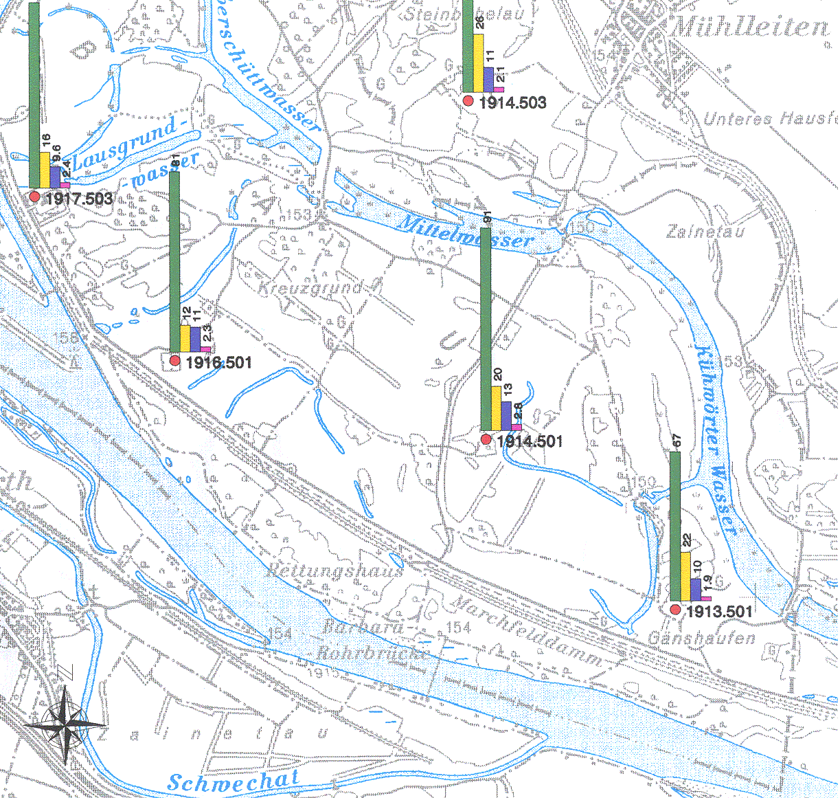
- Sitemap of stations:
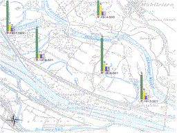 After selecting a map measurement stations of HIS'3D®
are drawn directly in it - with maps from different sources (e.g. from ArcInfo™).
The presentation optionally uses inscriptions of the stations and automatically selected symbols, both
based on station data in the database. The ArcView layout is created automatically (with a legend).
After selecting a map measurement stations of HIS'3D®
are drawn directly in it - with maps from different sources (e.g. from ArcInfo™).
The presentation optionally uses inscriptions of the stations and automatically selected symbols, both
based on station data in the database. The ArcView layout is created automatically (with a legend).
- Value presentations: Values are assigned to stations as bargraphs or pie charts,
using different parameters over one time interval or one parameter over several intervals or a combination of both.
- Requests out of ArcView: using new buttons and menus in ArcView the user can
directly access station and measurement information of the environmental database: he selects a station graphically
and access data per a button press.
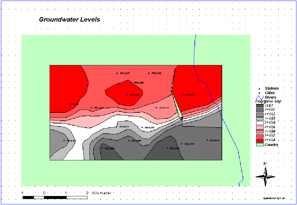
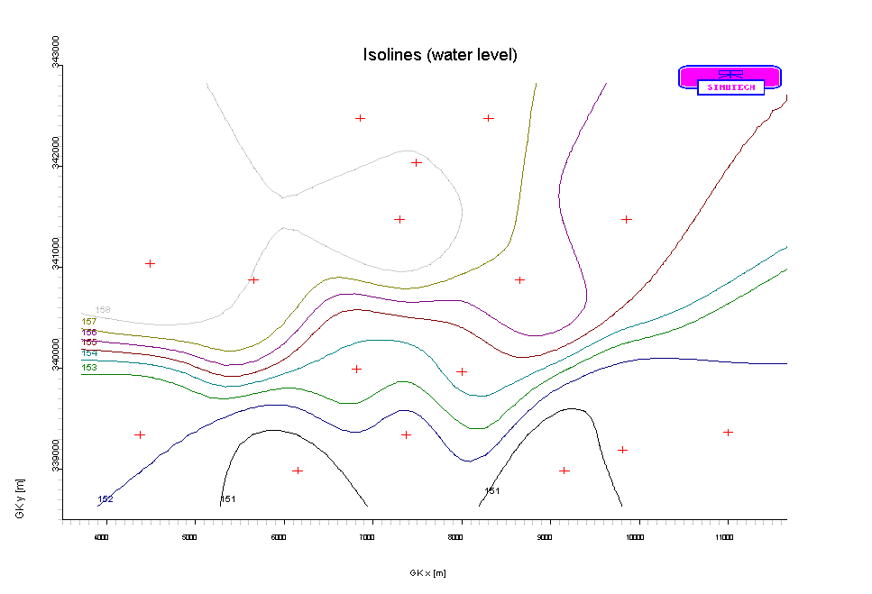
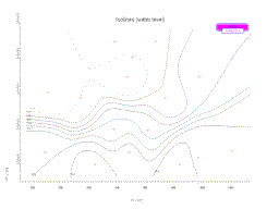
HISoline
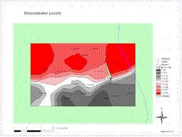
is the isoline module for HIS'3D® .
- It offers possibilities to create isolines for different types of values:
- over any parameter (e.g. water level, chemical parameters, physical parameters)
- mean, minimum, maximum over time interval or for a singular environment report
- Features:
- isolines (from, to, distance)
- variogram
- surface (choosable net)
-
The export is available as
- export file
- HIS'3D® -graphics
- in ArcView on a map.
- for hydrographical evaluations:
- fixlines: are predefined profiles, whichs height values ares used a fixed values during computation
- isolators: area areas without values (e.g. retention walls near to rivers; geological slips); with
exact computation on the border lines
Use the info-form to request further information.
 After selecting a map measurement stations of HIS'3D®
are drawn directly in it - with maps from different sources (e.g. from ArcInfo™).
The presentation optionally uses inscriptions of the stations and automatically selected symbols, both
based on station data in the database. The ArcView layout is created automatically (with a legend).
After selecting a map measurement stations of HIS'3D®
are drawn directly in it - with maps from different sources (e.g. from ArcInfo™).
The presentation optionally uses inscriptions of the stations and automatically selected symbols, both
based on station data in the database. The ArcView layout is created automatically (with a legend).